WELCOME

James and Fran welcome you to an account of their travels

Wednesday, 26 January 2011

NEW ZEALAND PART 5


THE WEST COAST: 16/12 - 20/12

After we left Queenstown we travelled North, in lovely weather, to lake Wanaka, which is like Queenstown on a smaller scale with lots of water-borne and mountain activities along with beautiful scenery. However the next morning there was low cloud and rain and, since we could not see the scenery, we decided to continue our journey to the West coast and northwards. There is little we can tell you about the scenery on the West coast as we did not see anything beyond the road for 4 or 5 days owing to the rain and low cloud coming in from the Tasman Sea.

What we do know is that it is an area of sub-tropical rain forest and that lichen grows on everything from trees to fence posts.

An example of the lichen that grows on every thing that does not move.

One extraordinary feature we were aware of was how sub-tropical rain forest can grow on near vertical rock faces without the trees falling off. It all starts with the lichen which grows on the rock face and then, when there is a thick covering, saplings start to grow and interweave their roots so that over a long period of time a strong base is formed for trees to grow. (This is pretty boring stuff but reflects how boring it can be driving in heavy rain and mist for 4 days!)

 
This sign was a few feet away from our van when we camped beside Lake Paringa. The water was nowhere near it so we reckoned we would be OK, however.....

the view from the rear window of the van the next morning showed the well defined bank had disappeared and lake had advanced significantly.

The name and motto of the bar in a camp site near the Franz Joseph glacier indicate that rain is not unusual in those parts.


The Franz Joseph glacier is a 'must see' and is one of the few advancing glaciers remaining in the world. However there is a 2 mile walk to the face of the glacier from the nearest car park and the rain was torrential.

Fran has just discovered that putting a water resistant jacket in the washing machine destroys the water resistant properties.

This is a close as you can get to the face without a guide. The fellow telling me to stop is actually a cardboard cut-out.

The intrepid explorer returns to the van in a jacket which had long since given up all resistance to the rain.


We passed through Greymouth which, as it's name suggests, is a pretty grey place and set in the heart of the coal mining area. There is a monument at the roadside dedicated to the miners killed in the Strongman Mine disaster in 1967 and there were tributes laid around it to the miners killed in the recent Pike River mine which is nearby.

Rather bedraggled tributes to the Pike River miners.

The so called 'pancake rocks' on the coast at Punakaiki. The way in which they have weathered is supposed to make them look like piles of pancakes, which says a lot about New Zealand food!

Our first Christmas decoration! He had travelled with us from the UK as a gift from Georgie and Olivia.

In pride of place in the cab.


NELSON/PICKTON 20/12 - 22/12

Nelson is a seaside resort and not particularly remarkable apart from the fact that the sun began to shine for us again there.


We were able to use the bikes again.

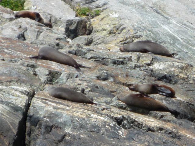
Dr Doolittle is at it again.

The port at Picton with 2 inter-island ferries preparing to depart for the North Island.


Well on our way down Queen Charlotte Sound which is spectacularly beautiful, and is not just a means to an end in travelling between the islands but stands alone as one of the things that should be seen in NZ.


This is the entrance to Queen Charlotte Sound, or in this case the exit to the Cook Strait. It is incredibly narrow for large ships and marks the end of the calm waters and light winds of the Sound. There were gale force winds and very rough seas in the Strait. 


Friday, 7 January 2011

NEW ZEALAND PART 4.

The next stop was inland and North to Queenstown, which is beautifully located on a lake with mountains all around.

Approaching Queenstown on the banks of Lake Wakatipu.


Looking down at Queenstown from the cable car nearing the top of Kelvin Heights. The Incredibles mountain range is in the background. (So called because incredibly the peaks are lined up precisely between true North and South)


It is the adventure capital of NZ with just about any adrenalin-rush sport you can think of available in the area. It is amazing the imagination that has gone into inventing activities which generally rely on gravity, water and lengths of industrial strength rubber bands.

Fran is prepared for an extreme activity by a nice young man, but appears to be having second thoughts.


Going...


Going...


Gone!

There were a series of 6 zip wire runs set up in the forest at the top of Kelvin Heights and actually it was great fun, and believe it or not Fran did enjoy it.


Looking down on a paraglider who launched himself off the Heights.


Looking up at a parasail who's pilot missed his landing ground the other side of the trees and ended up wrapped around this lamp post.

Fortunately he wasn't hurt and is standing beneath the lamp post in the blue shirt anxiously watching the local fire brigade retrieve his tangled mode of transport.

The town is really buzzing with lots of bars and restaurants full of young people. Although Fran and I raised the average age significantly we really enjoyed our time there.

Some lads rigged up a tightrope over the edge of the lake and entertained those of us having a drink in the town centre at the waters edge. Sometimes they were successful....


But usually not!


Fran declined my offer to pay for her to jump off a rather high bridge over a river as this deranged fellow has just done. (No, it is not me.)

NEW ZEALAND PART 3.

The most southerly point in the South Island.

We have now reached the most southerly point of mainland New Zealand, the most southerly part of the entire country being Stewart Island which we did not have time to visit, and we turned northwest towards Milford Sound. The scenery now changed completely from the green hills of the East coast, which reminded us very much of Dorset in places, to the mountainous subtropical rainforests of the southwest coast.

This pond is called 'Mirror Pond.' You can see why.


Not sure why I put this in - just liked the name.

The road into Milford Sound climbs through the mountains and through the Homer Tunnel just below the highest ridge. This has traffic lights which only change every 15 minutes.

Waiting to enter the Homer Tunnel.

Milford Sound is one of the main attractions in New Zealand. There is no town as such, just the small harbour where the tourist boats sail from. The main problem there are the swarms of sand flies which are continuously buzzing around and will give you nasty bites if you haven't sprayed yourself with foul smelling insect repellent.

Equally annoying, and similar in behaviour in many ways, are the swarms of Japanese tourists who travel everywhere by the coachload. We lost count of the number of times we would be enjoying an attraction only to have the whole thing ruined by a coach turning up and disgorging a swarm of Japanese.

Happily in Milford they seemed to have their own boats laid on so we had a more or less Japanese free cruise. Milford is named after Milford Haven, and in fact Milford Sound is misnamed as it is not a sound, created by river erosion, but a fjord created by glacial erosion.

Mt. Mitre, at the edge of Milford Sound, is one of the highest peaks in the world that rises directly from the water.


A waterfall on the other side of Milford Sound.


Seals basking on rocks at the narrowest point in the fjord. The wind is always very strong here and blows away the sand flies which bother the seals as much as us humans.


At the mouth of the fjord with the Tasman Sea ahead.


Looking back at the mouth of the Fjord from the sea. Captain Cook ignored the fjord as he thought it was just a small bay as he sailed past so it doesn't appear on his maps.


Up close to the bottom of one of the waterfalls.


That 'one deck below' shot again.


NEW ZEALAND PART 2.

From the centre of the South Island we made our way back to the East coast then continued South. The East coast is very fertile with most of the land being pasture for huge herds of cattle and, although there was no shortage of rain when we passed through, massive irrigation rigs dominate the landscape.

Irrigation rigs like this one keep the pasture lush for the cattle, although in this case a crop is being watered.


Every now and then you come across interesting phenomena such as these peculiar weathered sandstone rocks known as the 'Elephant Rocks.'


Or these perfectly spherical boulders at Moeraki, which have not been formed by erosion in the sea but have grown like an oyster with lime deposits from the water building around a seed. This seed is often a dead turtle or piece of wood which will be found fossilised in the middle of the boulder.


The lighthouse at Nugget Point.


And the 'Nuggets' below which it ensures shipping stays clear of.

Curio Bay is an interesting place with a petrified forest on the beach and home to the rare Yellow Eyed penguin.


A petrified tree trunk. (Take my word for it)

We spent a while exploring the beach but the Yellow Eyed penguin was nowhere to be seen. Then Fran caught a brief glimpse of one in the bushes at the top of the beach so we decided to sit quietly in a hollow in a rock and wait for it to re-appear. There were very clear signs around the beach instructing people never to go nearer to a penguin than 2 metres so we had ensured we kept our distance from the bushes.

We waited and waited but nothing happened and  I was reminded of a documentary I had seen about the incredible patience of the wildlife film crews who work on David Attenborough's programs. While we were sitting there focused on the bushes with our backs to the sea we became aware of a person waiving to us. We politely waved back but their waving seemed to intensify with the addition of some pointing. We were a little bemused and casually looked round only to see a Yellow Eyed penguin standing about a metre behind us. He seemed quite calm but it gave us a start, and we were very aware we had broken the 2 metre rule. We hastily retreated out of his way and he continued up the beach and into the bushes. It is unlikely David Attenborough will be requiring our services in the near future.


Returning home to his wife.

We stayed the night in a Department of Conservation (DOC) camp site just above the beach and looking out over the bay you could see Hector's Dolphins darting gracefully in and out of the water quite close to the beach. There were also warning signs about Sea Lions which we did not take too seriously.

We decided to go for a walk in the evening and as I was locking the van door I heard a shout from Fran, who had gone ahead, and she came running back round the corner in quite an agitated state. Before I could enquire what on earth was going on an enormous, snorting  sea lion came lurching round the corner in hot pursuit. I reckon I had the door unlocked and we were both back in the van in about a tenth of a second.

This was what came round the corner at high speed and snorting in a most aggressive manner.


He is beginning to calm down.

Quite a little crowd gathered around our van as he began to calm down, lead by a dishvelled and shaken young german tourist who had been confronted by the sea lion as he came out of the shower.


.
Much calmer now.

Something had obviously spooked him, being confronted by a german tourist coming out of the shower would probably do it, but when he had calmed down he made his way slowly across the camp site and back to the sea. His progress was followed by a man from the DOC with a portable warning sign which he kept picking up and placing down again in order to inform our little crowd, who were also following, that this animal could be dangerous! Hilarious but true.


The man from the DOC has done his duty!


The excitement is over and the sun sets serenely over the bay.